MAPPING ILLUSIONS
2014 - 2018Hundreds of square kilometers of Western Sahara are camouflaged by Google Earth. Blurring techniques vary depending on the year and location, government requests - and make a number of issues and illegal activities invisible.
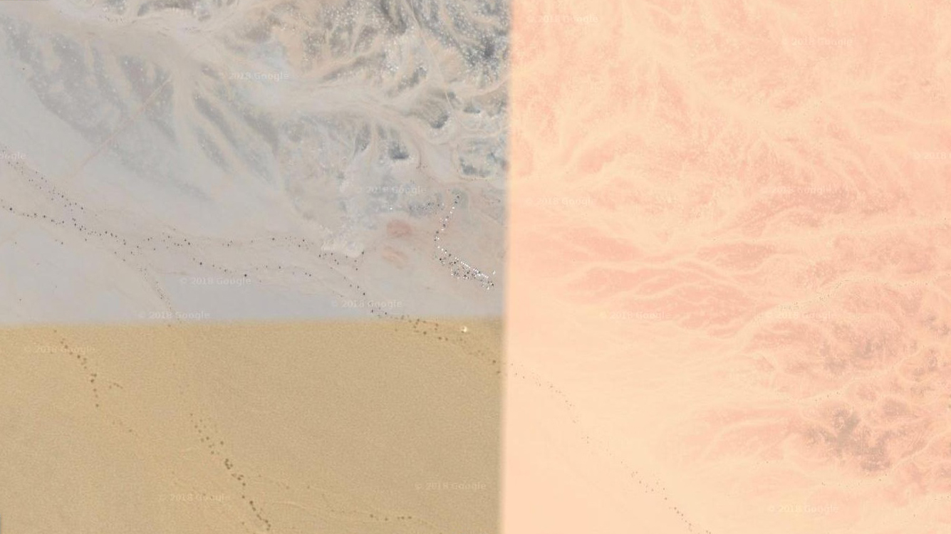
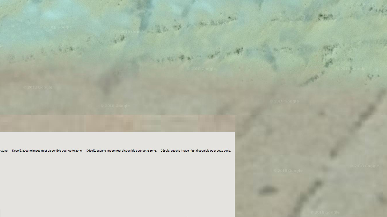
Cartographic tool and geopolitics are linked. Google maps is the reference for users today. However, by zooming into this desert, manipulated images emerge and the anomalies reveal a political "trompe l'oeil" illusion.
Cartographic tool and geopolitics are linked. Google maps is the reference for users today. However, by zooming into this desert, manipulated images emerge and the anomalies reveal a political "trompe l'oeil" illusion.
This project is a directory of censorship forms and techniques operated by Google. Blurring, erasing, collage,
falsified dates, patchworks of photos corresponding to other areas,
black squares, or gray squares accompanied by the mention "Sorry, no image is available for this area".
Google map is a political instrument that contributes to the invisibilization of this conflict
Google map is a political instrument that contributes to the invisibilization of this conflict